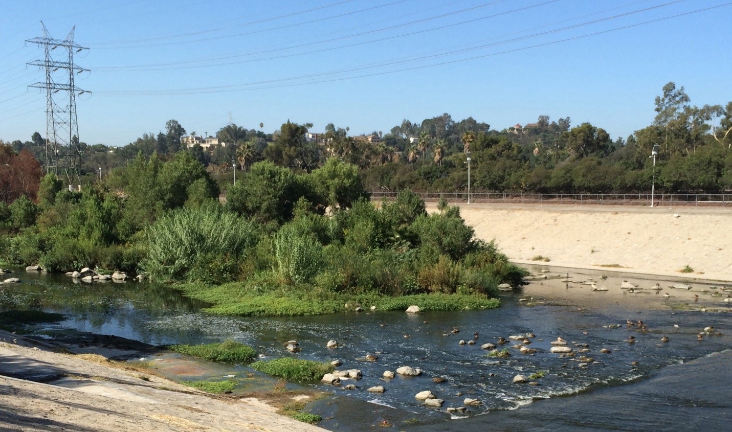
Riparian vegetation in the soft-bottom section of the Los Angeles River. This habitat could be improved through habitat enhancement measures such as invasive species removal. Photo: Shona Ganguly
How do we guide urban infrastructure investments to solve problems for people and nature?
Riparian vegetation in the soft-bottom section of the Los Angeles River. This habitat could be improved through habitat enhancement measures such as invasive species removal. Photo: Shona Ganguly
Greater Los Angeles will undergo major transformations in the coming years due to population growth and infrastructure upgrades required for environmental protection and human health. Investments to address stormwater issues alone are estimated at $20 billion over the next decade.
These investments present an opportunity to use natural solutions to address the needs of city dwellers. Los Angeles has some examples of infrastructure that benefit people and nature concurrently, but these have been piecemeal, with no clear understanding of how they contribute to larger regional goals. In addition, while we have a strong theoretical framework for how to use information about urban landscapes to inform conservation efforts, we lack a vision for conserving and enhancing biodiversity in Los Angeles, specifically.
Conservation plans typically exclude urban areas and focus instead on landscapes outside of cities. Thus, most cities have no pre-existing, comprehensive analysis of biodiversity or conservation values that could be used to further goals for habitat-supporting infrastructure development, and many of the techniques used to develop regional plans for biodiversity cannot easily be applied to an urban landscape. Our challenge is to develop a new methodology that can inform urban biodiversity conservation in Los Angeles and beyond.
To meet this challenge, Conservancy scientists are working together with researchers at the Natural History Museum of Los Angeles County on ¡BAILA! (Biodiversity Analysis in Los Angeles) in a new science partnership to develop an urban biodiversity planning methodology and produce a spatially-explicit vision for the protection and enhancement of biodiversity in Greater Los Angeles.
First, we are categorizing the built landscape of Los Angeles County into a handful of land cover types using data available for characteristics such as tree cover, paved surfaces, temperature, and soil texture. Then, we will incorporate select data from citizen science programs such as iNaturalist, ebird, and the Natural History Museum’s RASCals and BioSCAN projects to correlate our land categories with known sites where species have been documented, and look for patterns in which types of urban habitats support which suites of species.
With these results, we will use our conservation planning expertise to develop a model of where species are likely to occur in urban habitats—beyond the places where they have already been detected. This will give us an understanding in the current patterns of biodiversity in Los Angeles. By including of data on site-specific proposals for new infrastructure, we will develop information that can be used to guide habitat restoration in the built environment in conjunction with infrastructure development.
By involving agency partners in the development of the assessment from the beginning, including those involved in planning major infrastructure projects, we ensure that our work will be both wanted and valuable by those who will use it.