How can science inform – and help facilitate – the design of a statewide network of Marine Protected Areas?

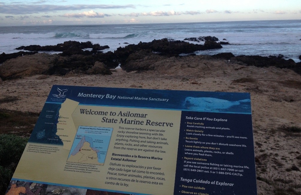
The 1999 Marine Life Protection Act (MLPA) mandated that the state give marine life a chance to rebound by establishing a network of marine protected areas (MPAs) that limit fishing and other extractive activities along the coast. Photo: Mary Gleason
For decades, California’s fisheries boomed. Coastal communities enjoyed generous catches that poured hundreds of millions of dollars into the state’s economy. But by the late 1990s, several California fisheries were showing signs of depletion. Rockfish, lingcod, and sea bass populations had plummeted. Years of overfishing and the use of destructive gear like bottom trawls were taking an obvious toll on both sea life and the economy.
Concerned state lawmakers took aim at reversing these trends when they passed the Marine Life Protection Act (MLPA) in 1999. The law mandated that the state give marine life a chance to rebound by establishing a network of marine protected areas (MPAs) that limit fishing and other extractive activities along the coast. The legislation specified that MPA siting decisions had to meet rigorous scientific guidelines, ensuring enough diverse habitats for the reserve system to work for a broad array of marine species.
MPA design processes are notoriously contentious as fishermen and other resource users fight to protect their access, and this can doom the effort. So, the MPA network design process also had to take into account how communities and industries would be affected and include stakeholders in decision-making.
The ambitious marine planning effort required strong science engagement, skilled negotiations, and an inclusive public process. Recognizing the importance of the effort, the Conservancy loaned two science staff with years of marine spatial planning experience to help facilitate what turned into a seven year effort. At the time, the Conservancy had already been working with fishing communities in the Central Coast of California, and even owned a significant number of fishing permits. Early successes in that program helped to establish credibility with fishermen, scientists, and conservationists, and allowed our participating scientists to play an interested, yet impartial advisory role, in fulfilling the MLPA mandate.

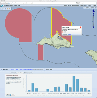
Conservancy staff helped transform the MPA planning process by collaborating with the Marine Science Institute at the University of California at Santa Barbara to create a new software program, MarineMap, specially-designed to facilitate transparency and hands-on stakeholder involvement.
Our staff also helped transform the planning process itself by collaborating with the Marine Science Institute at the University of California at Santa Barbara to create a new software program, specially-designed to facilitate participation. Marine Map allowed stakeholders to view spatial data, map out proposals and get rapid analysis illustrating the trade-offs inherent in different MPA design possibilities. Equally important was that the software was user-friendly, and provided an unprecedented level of transparency and hands-on stakeholder involvement. The MarineMap technology was refactored into SeaSketch.org and has exported the lessons of the MLPA to over 100 marine spatial planning projects around the world.
The resulting protected area network, approved in stages and finished in 2012, spans four regions from California’s southernmost tip to the northern border. With 124 MPAs, covering 16 percent of state waters, it is the largest marine protected area network in the U.S. Over 9% are “no-take” areas, providing a complete refuge for fish, allowing them to mature and reproduce, eventually replenishing life both inside and outside the MPA network.
Early monitoring results of the reserves established first in the Channel Islands show that important lobster and rockfish populations are already showing signs of recovery.
Emily Saarman, Mary Gleason, John Ugoretz, Satie Airamé, Mark Carr, Evan Fox, Adam Frimodig, Tom Mason, Jason Vasques
This paper explores four key conditions that supported the successful integration of science into the Marine Protected Area network planning effort in California. The redesigned statewide network of…John Kirlin, Meg Caldwell, Mary Gleason, Mike Weber, John Ugoretz, Evan Fox, Melissa Miller-Henson
This paper reviews how recommendations developed through the Marine Life Protection Act (MLPA) Initiative supported regulatory decisions by the California Fish and Game Commission to greatly expand…Mary Gleason, Evan Fox, Susan Ashcraft, Jason Vasques, Elizabeth Whiteman, Paulo Serpa, Emily Saarman, Meg Caldwell, Adam Frimodig, Melissa Miller-Henson, John Kirlin, Becky Ota, Elizabeth Pope, Mike Weber, Ken Wiseman
This paper reviews the design of a network of marine protected areas (MPAs) in state waters as mandated by the Marine Life Protection Act (MLPA). A public–private partnership (the MLPA…Evan Fox, Melissa Miller-Henson, John Ugoretz, Mike Weber, Mary Gleason, John Kirlin, Meg Caldwell, Sonke Mastrup
In California, after two unsuccessful attempts, statewide planning of a network of marine protected areas (MPA) was achieved through the California Marine Life Protection Act (MLPA) Initiative. This…Evan Fox, Sean Hastings, Melissa Miller-Henson, Dominique Monie, John Ugoretz, Adam Frimodig, Craig Shuman, Brian Owens, Rebecca Garwood, Darci Connor, Paulo Serpa, Mary Gleason
This paper explores the strategies used to address policy issues that arose in marine protected area (MPA) planning process in California. The authors provide examples from six specific topic…Matthew S. Merrifield, Will McClintock, Chad Burt, Evan Fox, Paulo Serpa, Charles Steinback, Mary Gleason
This paper reviews the creation and use of MarineMap, a spatial decision support system that enabled stakeholder participation in designing marine protected areas (MPAs). The authors highlight why it…Evan Foxa, Eric Poncelet, Darci Connor, Jason Vasques, John Ugoretz, Scott McCreary, Dominique Monié, Michael Harty, Mary Gleason
This paper examines how differences in regional characteristics and lessons learned influenced three important elements of the stakeholder process of California's Marine Life Protected Area (MLPA)…Dan Laffoley, Alan T. White, Stacey Kilarski, Mary Gleason, Scott Smith, Ghislaine Llewellyn , Jon Day , Annie Hillary, Victoria Wedell, Daphine Pee
With government, agency and organizational partners, Conservancy scientists helped publish an IUCN guidebook to inspire conservation investment in global marine protection and provide a case study…